The News in DataSCIENCE
№ 018 · OCT. 17, 2026

Amazon Deforestation Has Fallen To Its Lowest Level In A Decade

Brazil’s space agency logged 1,110 square miles of deforestation alerts in the Amazon over the year through July, about a third less than the year before and less than half the average of the past decade.

By Samuel W. Bennett · Sources: INPE (PRODES and DETER), Agência Brasil
1,110 sq miAMAZON CLEARING FLAGGED,
AUG. 2025–JULY 2026
−56%COMPARED WITH THE
PREVIOUS DECADE’S AVERAGE
Brazil’s National Institute for Space Research, known as INPE, has measured how much of the Amazon is cleared each year since 1988 with a satellite survey called PRODES. The worst year on record was 1995, when about 11,200 square miles were cleared, and 2004 came close behind at 10,700, an area about the size of Massachusetts.
Brazil then expanded satellite monitoring, created new protected areas and stepped up fines for illegal clearing. By 2012 the yearly loss had fallen to 1,765 square miles, 84 percent below the 2004 level and still the lowest year in the survey.
The gains did not hold. Clearing climbed for most of the next decade and reached 5,034 square miles in 2021, nearly three times the 2012 low. Since then it has fallen four years in a row, to 2,238 square miles in 2025, down 56 percent from 2021 and the third-lowest year since 1988.
INPE also runs a faster system called DETER, which flags new clearing every day so enforcement teams can respond. Its alerts for August 2025 through July 2026 covered 1,110 square miles, more than a third below the year before and the lowest total since the current system started in 2015. That is a bit smaller than Rhode Island.
Five of the six states with the most alerts saw declines. Pará still led with 381 square miles, followed by Mato Grosso. Roraima moved the other way, with alerts up 32.5 percent, a reminder that the improvement is uneven.
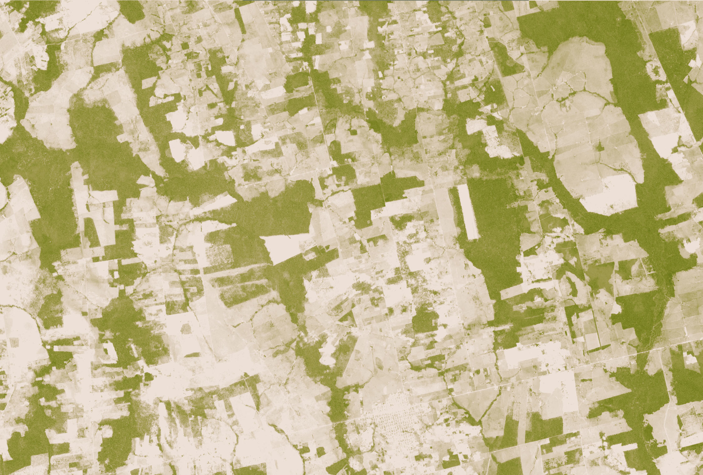
The Same Patch Of Rondônia, Six Years Apart
Drag the slider to compare 2000 with 2006, two years after Amazon clearing peaked in 2004
Satellite image of southern Rondônia, Brazil, on Sept. 9, 2000, mostly green forest with scattered cleared patches The same area on Sept. 26, 2006, with most of the forest cleared to tan land Sept. 2000Sept. 2006
ForestCleared land
Southern Rondônia, southwest of Pacaás Novos National Park. NASA Earth Observatory images by Robert Simmon, using ASTER data from NASA’s Terra satellite. Some of the paler forest in 2006 may reflect drought, logging, fire or a different viewing angle, according to NASA.

Why the alerts matter

DETER is built for speed rather than precision, so its totals run lower than the official PRODES rate, which INPE calculates from sharper images after the dry season ends. The two systems usually move in the same direction, though. In 2025, DETER alerts fell and the PRODES rate followed with an 11 percent drop. If that pattern holds, the official figure for 2026 has a real chance of beating the 2012 record low of 1,765 square miles.

Brazil’s government and outside researchers point mainly to enforcement. Brazil’s Amazon action plan, first launched in 2004, lost its funding in 2019 and was restarted in 2023 along with higher penalties for environmental crimes. Clearing also fell this year in the Cerrado, the savanna south of the Amazon, where alerts dropped about 8 percent.

What’s next

INPE usually publishes its first PRODES estimate for the year in November. A strong El Niño is expected to bring drought to the region into early 2027, which raises the risk of fire, and fire damage is counted separately from clearing. Brazil also holds a presidential runoff on Oct. 25, and the two candidates disagree about how far to go in regulating land use.

How we counted: annual figures are INPE’s PRODES rates for Brazil’s Legal Amazon, with consolidated values through 2024 and the official estimate for 2025 (5,796 km²); INPE’s 1988 figure is its average for 1977–1988. Alert totals are INPE’s DETER figures for Aug. 1, 2025, to July 31, 2026 (2,874 km²), the prior 12 months (4,495 km²) and the 2015/16–2025/26 average implied by INPE’s 55.6 percent comparison, as reported by Agência Brasil. INPE describes the one-year drop as 36.87 percent; the rounded areas give 36.1 percent, a gap the agency has not explained. We converted square kilometers to square miles (1 sq mi = 2.59 km²). Sources: INPE PRODES 2025 technical note, INPE/MMA PRODES presentation.